Handheld LiDAR
Handheld LiDAR scanners for walk-through capture
Talk to the people who use this gear every week, not a call centre.
Choose by the job
Which handheld scanner do I need?
Basics
How handheld scanning works
What the walk gives you, and what it does not.
What a handheld LiDAR scanner is
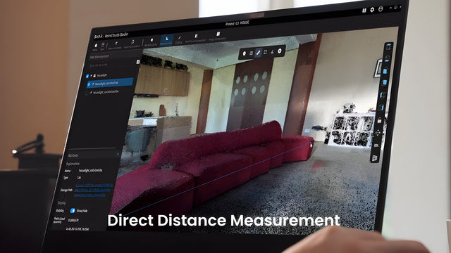
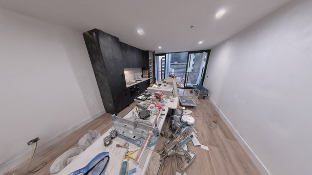
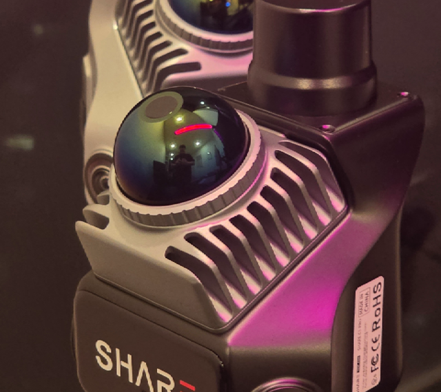
A handheld LiDAR scanner is a walk-through 3D capture tool you carry on site. It builds a colourised point cloud as you move, so interiors, stairwells, tunnels and under-canopy spaces become measurable geometry without a drone or a room full of tripods.
Phone RTK units such as viDoc Light sit in the same family when you need centimetre points and geo-tagged photos rather than a continuous SLAM cloud.
You leave with measured data for review, CAD underlay and handover. You do not leave with a finished drawing set or BIM model.
What you actually walk out with
You walk the site. The scanner builds a colourised point cloud as you go. That cloud is for review, measure and as an underlay in CAD. It is not a finished drawing set and it is not a BIM model.
Miss a wing and it stays missing. Check coverage on site. Rescan before you leave.
Relative vs absolute
Relative accuracy asks whether the cloud holds together. Absolute accuracy asks whether it sits on a real-world datum.
Outdoors, SHARE C1 Pro, C10 and viDoc Light can take AUSCORS NTRIP. Indoors you still bridge with SLAM or control. Brochure centimetre claims are not interchangeable across vendors or jobs.
When the drone is still the right tool
Open yards, roofs and big outdoor surfaces are usually faster from the air. Handheld wins under canopy, indoors, in tunnels and anywhere a tripod circus slows you down.
Most programmes that care about the whole site use both and register the clouds in one project.
Handheld vs drone vs terrestrial
| Method | When it wins | Typical Australian sites |
|---|---|---|
| Handheld SLAM / phone RTK | Indoors, under canopy, tunnels, plant, occupied buildings. Fast walk-through without a tripod circus. | Plant rooms, stairwells, underground, heritage interiors, stockpile checks under cover. |
| Drone LiDAR / photogrammetry | Open yards, roofs, corridors and large outdoor surfaces where airspace and CASA rules allow. | Mine pits, corridors, roofs, farm and civil earthworks in open sky. |
| Terrestrial / tripod scanner | Highest static detail on a fixed setup when you can afford station moves and clear lines of sight. | Facades, controlled interiors, heritage where every station is planned. |
Most programmes that care about the whole site use more than one method and register the clouds in one project. Handheld is not a drone replacement outdoors in open sky.
After the walk
Capture runs the job on site. PointClouds Studio is where you process and check the cloud. MapShare is how you send a client a link instead of a ZIP.
Most jobs leave as LAS, LAZ, E57 or PLY for CAD. 3D Gaussian Splatting is optional, needs NVIDIA CUDA, and is for showing a space, not for delivering a whole site as engineering data.
For site write-ups and accuracy notes, read Ground Truth. That is where we publish the benchmarks we run before they go into marketing.
Handheld scanner ladder
| Spec |
viDoc LightviDoc
|
SHARE C1SHARE
|
SHARE C1 ProSHARE
|
SHARE C10-16SHARE
|
SHARE C10-32SHARE
|
SHARE C10-32 ProSHARE
|
|---|---|---|---|---|---|---|
| Role | Phone RTK rover | Handheld SLAM | Handheld SLAM + RTK | Industrial handheld SLAM | Industrial handheld SLAM | Flagship industrial SLAM |
| Sensing | Phone camera + RTK mount | Livox Mid-360 | Livox Mid-360 | Hesai XT16 (16-ch) | Hesai XT32 (32-ch) | Hesai XT32M2X (32-ch) |
| Typical range | Point pickup (not SLAM) | 40 / 70 m (10%/80%) | 40 / 70 m (10%/80%) | 120 m | 120 m | 300 m |
| Points/sec | Not applicable | 200k | 200k | 320k | 640k | 640k (to 1.92M triple) |
| Accuracy (class) | cm-class with NTRIP fix | rel <1 cm; abs needs control | rel <1 cm; abs <5 cm (RTK) | rel ≤1 cm; abs with RTK | rel ≤1 cm; abs with RTK | rel ≤1 cm; abs ≤5 cm |
| RTK | Yes (NTRIP) | No | Built-in NTRIP | Yes | Yes | Yes |
| Weight | Phone + mount | ~955 g | ~955 g | Backpack system | Backpack system | Backpack system |
| Best for | Control and detail pickup | Interiors and GPS-denied | Mixed indoor / outdoor | Entry into large sites | Plant, pits, complex sites | Long range and heavy sites |
viDoc Light
viDoc
- Role
- Phone RTK rover
- Sensing
- Phone camera + RTK mount
- Typical range
- Point pickup (not SLAM)
- Points/sec
- Not applicable
- Accuracy (class)
- cm-class with NTRIP fix
- RTK
- Yes (NTRIP)
- Weight
- Phone + mount
- Best for
- Control and detail pickup
SHARE C1
SHARE
- Role
- Handheld SLAM
- Sensing
- Livox Mid-360
- Typical range
- 40 / 70 m (10%/80%)
- Points/sec
- 200k
- Accuracy (class)
- rel <1 cm; abs needs control
- RTK
- No
- Weight
- ~955 g
- Best for
- Interiors and GPS-denied
SHARE C1 Pro
SHARE
- Role
- Handheld SLAM + RTK
- Sensing
- Livox Mid-360
- Typical range
- 40 / 70 m (10%/80%)
- Points/sec
- 200k
- Accuracy (class)
- rel <1 cm; abs <5 cm (RTK)
- RTK
- Built-in NTRIP
- Weight
- ~955 g
- Best for
- Mixed indoor / outdoor
SHARE C10-16
SHARE
- Role
- Industrial handheld SLAM
- Sensing
- Hesai XT16 (16-ch)
- Typical range
- 120 m
- Points/sec
- 320k
- Accuracy (class)
- rel ≤1 cm; abs with RTK
- RTK
- Yes
- Weight
- Backpack system
- Best for
- Entry into large sites
SHARE C10-32
SHARE
- Role
- Industrial handheld SLAM
- Sensing
- Hesai XT32 (32-ch)
- Typical range
- 120 m
- Points/sec
- 640k
- Accuracy (class)
- rel ≤1 cm; abs with RTK
- RTK
- Yes
- Weight
- Backpack system
- Best for
- Plant, pits, complex sites
SHARE C10-32 Pro
SHARE
- Role
- Flagship industrial SLAM
- Sensing
- Hesai XT32M2X (32-ch)
- Typical range
- 300 m
- Points/sec
- 640k (to 1.92M triple)
- Accuracy (class)
- rel ≤1 cm; abs ≤5 cm
- RTK
- Yes
- Weight
- Backpack system
- Best for
- Long range and heavy sites
By job
Applications
Pick the job closest to yours.
-
As-built surveying
Walk-through as-builts that hold up to a survey brief.
View job -
Scan to BIM
From a walk-through to a model your CAD team can open.
View job -
Mining & quarry
Pit, highwall, decline and plant. Complex sites, fewer passes.
View job -
Renovation and interiors
Interiors and stairwells your drone cannot reach.
View job -
Stockpile and volumes
Volumes under cover and on mixed sites.
View job -
Heritage and documentation
Colourised records without a forest of targets.
View job
Accuracy
Why accuracy numbers do not compare cleanly
Buy local
Why buy from Australia, not a grey import
Questions, answered
Choosing
How do I pick between viDoc, C1, C1 Pro and C10?
When is viDoc Light enough?
C1 or C1 Pro for renovation work?
When do we need C10 instead of C1 Pro?
Buying
Do I need a CASA licence to use one?
What does a handheld LiDAR scanner cost in Australia?
Can I hire or trial one before buying?
How much can I cover in a day?
Accuracy
What do the accuracy numbers actually mean?
Will glass, mirrors and shiny metal scan cleanly?
Workflow
Is the point cloud a finished CAD or BIM model?
What software do we use day to day?
Support
We missed a room. Can software invent it?
Bring a real site brief
Bring a real site. We put the scanner in your hands on it. You keep the data.