The NTRIP stream drops halfway down the corridor. The aircraft keeps flying. Back in the office the photos look sharp and the trajectory is a mess. That is the moment people discover whether they logged raw observations, or only a live fix that vanished with the phone hotspot.
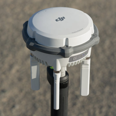
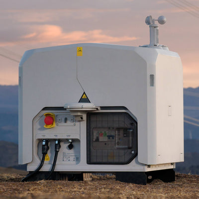
DJI split D-RTK 3 into two boxes that share a badge and almost no workflow. The Relay Fixed Deployment Version is a high-mounted radio for a parked aircraft. The Multifunctional Station is the portable GNSS unit: base, rover and the logger you need when the live correction never arrives. Mixing them up is how a pad site gets a mapping base it cannot use, and how a survey crew buys a relay that will not occupy a known mark.
What each box is allowed to do
DJI's own FAQ is blunt. The Relay Fixed Deployment Version only supports relay station mode, and it is meant for a fixed install with a docked aircraft. The Multifunctional Station supports relay, broadcast (base) and rover. That is the whole decision. Everything else is a consequence of those modes.
In broadcast (green light) the Multifunctional Station sends corrections to one or more aircraft. In rover (yellow light) it is a handheld on a pole, for occupying control and check shots. In relay (blue light) it sits high and carries the video and control link around a hill or a shed. Australia allows the 5 GHz band those relays use. Japan, Russia and Kazakhstan do not; we do, so relay is a real option here, not a brochure line.
The Relay Fixed Deployment unit is the dock-side flavour of that last mode. Power over Ethernet from the pad, Cat 6 up to 100 metres, a colder operating floor (minus 30 C against minus 20 C on the portable unit) and a backup battery that DJI quotes at about two hours after PoE dies. It can feed RTK to the aircraft by comparing the pad's corrections with its own and picking the cleaner source. It cannot be a rover. It cannot occupy a cadastral mark. It is not the PPK base you take to a borrow pit.


How a live fix is made, and why it dies
RTK is a difference. The rover (the aircraft) and a reference station observe the same satellites. The reference knows where it is, so the difference between its observations and the rover's is mostly atmosphere, orbit and clock. Apply that difference in real time and, with a fixed integer ambiguity, the rover sits centimetres from the reference.
DJI publishes the portable station in rover mode, static, open sky, good geometry, quiet ionosphere, no multipath, at 0.8 centimetres + 1 ppm horizontal RMS and 1.5 centimetres + 1 ppm vertical RMS. Tilt compensation on the pole is a different number: 8 millimetres + 0.7 millimetres per degree, held under 2 centimetres within 30 degrees of vertical. Those are not mapping-cloud figures. They are the pole.
Leave the same box uncalibrated as a base and DJI quotes 1.5 metres horizontal / 3.0 metres vertical RMS single-point. Calibrate it from a network RTK stream and the published base accuracy tightens to 1.0 centimetre + 1 ppm horizontal and 3.0 centimetres + 1 ppm vertical RMS. Satellite-based PPP on the station is 30 centimetres / 40 centimetres RMS after a 20 minute convergence. If you occupy a random car-park and tell Terra the base is a known mark, you have inherited that first, loose number.
The live path still needs a radio. NTRIP (in Australia usually AUSCORS on ntrip.data.gnss.ga.gov.au:2101) needs a data link. Broadcast from your own base needs line of sight and a station that does not move. DJI will abort the mission if the Multifunctional Station detects displacement in base mode. That is the correct behaviour. It is also why a tripod on soft ground is not a base.
PPK is the same maths, later
Post-processed kinematic uses the same observations. You just apply them after the flight, so a dead hotspot does not kill the coordinates. DJI Enterprise RTK aircraft already write the rover files. The official workflow is five steps: plan a long enough mission, fly and keep the observation files, collect a matching reference, align on timestamps, overwrite the image POS before photogrammetry.
The rover folder is easy to recognise if you know the suffixes. Beside the JPEGs you want:
-
.nav: broadcast ephemeris -
.obs: rover observations in RINEX -
.binor.rtk: RTCM from the mobile station -
.mrk: exposure timestamps
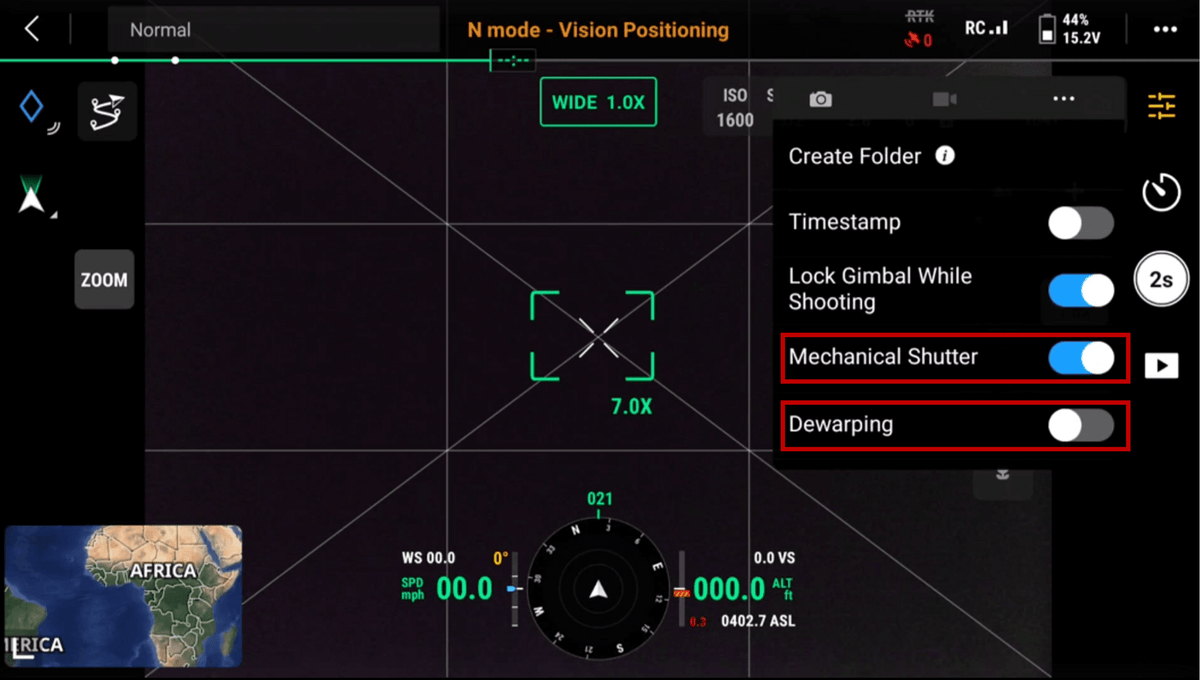
Without the observations and the timestamp file there is nothing to process. DJI's photogrammetry note is that automated missions usually start this logging. If you flew by hand, Create Folder in the camera settings starts a new directory and the logger with it.

On the reference side you have three honest Australian sources. A Multifunctional Station on a known mark, logging DAT (RTCM 3.2) for the whole flight plus a few minutes either side, exported over USB-C. A third-party base writing RINEX. Or a nearby AUSCORS / state CORS RINEX pulled for the same window. DJI's US write-up uses NGS CORS and warns off baselines over about 20 miles. Geoscience Australia's caster is the equivalent here; pick the nearest online mount, not a favourite from last month. For LiDAR PPK inside Terra, DJI wants the base within about 10 kilometres of the aircraft and the file renamed to sit beside the raw LiDAR folder (.obs for RINEX).
DJI Terra 4.4 and later will ingest the Multifunctional Station's DAT. Photogrammetry path: new reconstruction, POS Data, Local PPK, add the base file. LiDAR path: put the renamed base file in the scan folder and let Terra notice it. Either way you still have to name the coordinate system you think you are in.

The argument people actually have
NTRIP versus a local base is not a brand fight. It is a coverage fight. AUSCORS is the right default on a connected site with a nearby mount. A Multifunctional Station on a known point is the right default when the mount is far, the SIM is dead, or the client has given you a mark in MGA2020 / AHD and wants the model on that mark. PPK is the backup on both. It is not a reason to skip check shots. ICSM's control standard still expects independent checks; a processed trajectory is not a cadastral certificate.
GDA2020 is the datum. WGS84 ellipsoidal height is what GNSS natively speaks. Australian Height Datum is a geoid-based gravity surface. AUSGeoid2020 is the grid that converts one to the other. Occupy a mark in AHD, type the ellipsoid height into the base, and the whole model sits out by the N-value, which in Australia is tens of metres, not millimetres. DJI's PPK note tells you to set a D-RTK station on a known WGS84 geographic point with ellipsoid height. Translate that here: know which of those three numbers the mark actually is, before you press Apply.
Flight length is the other quiet requirement. DJI's PPK article gives a minimum of about 15 minutes of GNSS in the air so the filter has enough epochs. A four-minute stockpile loop can still look pretty. It may not PPK cleanly.
What breaks it
The Multifunctional Station must not move in base mode. DJI watches the IMU and the position; a bump, a tilt, a tripod leg sinking in spoil, and the app throws a displacement warning and ends the mission. Logging DAT through a power cycle: a new file is written each time you power off in relay or broadcast. Cover the flight with one file, or merge them before Terra.
Relay used as a mapping base is the SKU mix-up this post exists to stop. The Fixed Deployment unit will help a docked aircraft hold a link past a shed. It will not give you rover JSON for Terra's GCP manager. That JSON and CSV export is rover mode on the portable station, through the DJI Enterprise app, Mission Library, Export.
CORS chosen by habit is the NTRIP version of the same mistake. A 40 kilometre baseline through a wet ionosphere is not the 0.8 centimetre rover spec. Short baseline, four constellations, open sky on the base, mechanical shutter on, dewarping off for photogrammetry, latest camera firmware. Then PPK as insurance, not as a personality.
We have not published an Australian trial that puts AUSCORS NTRIP, a Multifunctional Station PPK solution and a CORS RINEX PPK solution on the same corridor against a total-station check network. The figures above are DJI's lab and support numbers, plus Geoscience Australia's caster rules. Until someone flies that comparison, treat brochure centimetres as a ceiling and put check shots on the hard surfaces you will be asked to defend.
What the reviewer should open
Before the model leaves the office: did the rover folder contain .obs and .mrk (or the LiDAR equivalent)? Does the base DAT or RINEX cover taxi out to motors off, not only the mapping lines? Is the base coordinate the occupied mark, in the right datum and height system, with the antenna height actually measured? Did Local PPK in Terra go green, and did you export POS rather than assuming the photos were rewritten? Do independent check shots on hard, open surfaces sit inside the spec you quoted, not inside a hope? If the flight was under 15 minutes, is PPK even claimed?
Where we stand
We sell and set up both units: the Multifunctional Station as the portable base, rover and PPK logger, and the Relay Fixed Deployment on pad sites that need the radio. AUSCORS NTRIP is what we put on most Australian kits; the portable station is what we add when the mount will not reach. We have not run a published three-way check of those paths on one Australian corridor.
If a flight already came home with a float, send the rover folder and the base DAT. We will tell you whether PPK has enough epochs to solve, and which coordinate you actually occupied.
FAQ
Can the Relay Fixed Deployment Version replace a mapping base?
No. DJI limits it to relay mode on a docked aircraft. Occupy marks and log PPK DAT on the Multifunctional Station.
Do I still need AUSCORS if I own a Multifunctional Station?
Often yes. NTRIP is how you calibrate the base to a national frame, and how the aircraft flies when you have coverage. The station is for sites the mount cannot reach, and for the DAT you process later.
Does PPK mean I can skip ground control?
No. PPK corrects the trajectory. Check shots still catch a wrong base height, a swapped zone and a geoid you never applied.