

SHARE C10-16
The entry point into the C10 series - a professional-grade handheld scanner built for complex environments and precise reconstruction. 16-channel mechanical LiDAR, an ergonomic backpack system, and 3-hour battery life make it the right tool for larger sites, tunnels, and multi-room interiors where the C1 starts to run out of room.
Ground Truth
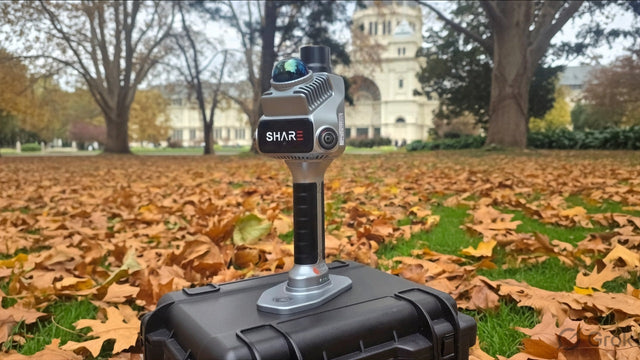

Discover SHARE C10-16


Compare Models
| Product Name | |||
|---|---|---|---|
| LiDAR Channels | 16 | 32 | |
| Point Cloud Rate | 320,000 pts/s | 640,000 pts/s | |
| Measuring Range | 0.05 ~ 120 m | 0.05 ~ 120 m | 0.5 ~ 300 m |
| Camera Quantity | 2 | 4 | |
| Sensor Size | 1-inch (13.13×8.76mm); Pixel Size 2.4μm | ||
| Effective Pixels | 16 MP | 20 MP | |
| Dimensions | 386.8mm×152.7mm×174.4mm | ||
| Weight | 2438g | 2328g | |
| Wi-Fi | Wi-Fi 6, 2.4G/5G; 20m | ||
| Storage | 1TB SSD | ||
| RTK Accuracy | Horizontal 0.8cm+1ppm; Vertical 1.5cm+1ppm | ||
| Backpack System | Standard Ergonomic Backpack System | ||
| Battery Capacity | 49.436Wh (3400mAh) × 2 | ||
| Operating Time | Approx. 180 mins | ||
| Point Cloud Thickness | Within 5mm | ||
| Relative Accuracy | Better than 1cm | ||
| Absolute Accuracy | Better than 5cm | ||


FAQ
Questions, answered
Choosing a model
Should I buy the S100 or the S20?
What's the difference between the S100-16, S100-32 and S100-32 PRO?
Who actually needs the 300 m range of the S100-32 PRO?
Buying & price
Why buy the S100 from Mirrormapper instead of SHARE's overseas store?
Accuracy
The S100 quotes the same accuracy as the S20 — so what am I paying extra for?
Do I need ground control points?
What if there's no RTK coverage at my site — mountains, deserts, underground?
Workflow & data
Can I merge S100 scans with my drone data?
How much data does it generate, and how do I get it off the unit?
In the field
At 2.4 kg, isn't it heavy to carry all day?
How long does it run on a charge?
Support
Is training included?
What warranty and support do I get?
Reviews
What customers are saying
Real feedback from teams using this equipment in the field.
Be the first to share your experience
Teams like yours rely on real field feedback before they buy. A quick review helps the next operator choose with confidence.
Takes about 2 minutes · Verified by Judge.me

Put the scanner on four legs
Pair the S20 RTK with a Unitree robot dog and walk georeferenced point clouds through tunnels, stopes, and hazardous ground, no operator inside. We'll integrate the payload and RTK for you.