Month-two's ortho is sharp. Sit it on month-one and the kerb is 80 millimetres out, always in the same direction. The camera did not drift. Someone changed the output coordinate system, or never named one, and the two reconstructions are two different guesses at the same ground.
That is the actual Terra problem on Australian sites that get flown again. Not whether a mesh-repair package can fill a hole in a roof. DJI Terra is where the flight becomes a measurable file. DJI Modify is where a mesh that already exists gets cleaned for a client who will not open a raw reconstruction. They are not interchangeable. The coordinate you pick in Terra is what makes the second flight comparable to the first.
What Terra actually computes
Photogrammetry in Terra is aerotriangulation, then a dense reconstruction. Each frame has a position and attitude (POS). Overlapping features tie the frames to each other. The bundle adjusts those ties against the POS and any control you gave it. From that sparse model it builds the ortho, DSM, mesh or point cloud you asked for.
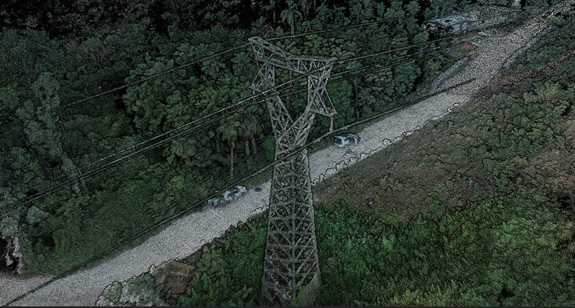
LiDAR in Terra is a different engine with the same obligation. The scanner already has points in a trajectory. Terra applies the POS, the IMU, optional PPK, then classification and the products. DJI's own geospatial FAQ is explicit on one limit that still catches people: Terra does not import GCPs onto L-series LiDAR. Control on a LiDAR cloud goes through a third-party package. Photogrammetry is where Terra's GCP manager lives.
None of that is mesh repair. Terra answers what the flight measured. If the POS is a float, or the output CS is WGS84 UTM when the drawing is MGA2020 Zone 55 with AHD, the reconstruction can look internally tight and still sit in the wrong country, or the right country at the wrong height.
What Modify is for
Modify does not ingest a memory card. It takes a mesh Terra (or something else) already built, fills holes, knocks off noise, simplifies geometry and writes a file a non-surveyor can open. Use it when the reconstruction is done and the delivery still looks like a reconstruction.
Most mapping programs need Terra. Fewer need Modify. The ones that do are usually handing a mesh to an architect or a stakeholder viewer, not a set of levels to a registered surveyor. If you only process orthos and LAS, you may never licence it. That is not a slight. It is the split.
Seven parameters, and why a repeated site cares
A similarity transform in three dimensions has seven numbers: three translations, three rotations, one scale. Surveyors have used that shape for decades to move a geodetic system onto a local grid. Terra exposed it in v3.5.0 as seven-parameter transformation under Reconstruction, Advanced, Output Coordinate System, Arbitrary Coordinate System.
DJI's write-up is for a small mapping area (they say on the order of 50 square kilometres) or a single construction site that gets flown on a cadence. Feed known pairs (source latitude, longitude, height; target East, North, up), let Terra calculate DX, DY, DZ, the three rotations and the scale, then Apply. Or import a previous JSON so month-two uses the same seven numbers as month-one. LiDAR reconstructions can take the same transform. Merged Outputs will stack multiple scans into one LAS, PLY or PCD, which is only useful if they already share that frame.


The honesty DJI slightly buries: "without placing GCPs" means you already have coordinates for the pairs. You are not inventing a local grid from nothing. You are applying a known transform. If you do not have those pairs, you still occupy marks, or you pick a known coordinate system Terra already lists and you live with that system's definition.
Australian frame, not a US zone
The v3.5 stills show WGS84 / UTM and NAD83. That is a Chinese and US default list from 2022. An Australian drawing is almost always GDA2020, a Map Grid of Australia zone, and Australian Height Datum via AUSGeoid2020. GDA94 still appears on older control. The conformal 7-parameter between GDA94 and GDA2020 is a national transform published by ICSM. It is not the same seven numbers as a contractor's site grid that was set out from a local origin in 2009.
So the checklist in Terra is:
- Horizontal: GDA2020 / MGA zone matching the drawing, or a PRJ the client supplied, or seven-parameter from occupied pairs on that grid.
- Vertical: ellipsoid, or AHD through the geoid grid Terra has been given. Mixing them is how a roof lands 20-odd metres in the air.
- Save the reconstruction template. Month-two is a copy, not a remix.
If the known-CS search in your Terra build does not list the GDA2020 zone, do not pick the nearest UTM and "shift it in CAD". Import the PRJ or calculate seven-parameter from marks you actually occupied. Water: Terra's Refine Water Surface exists because photogrammetry invents texture on a moving lake. Turn it on when the reconstruction includes water, and do not quote levels off the invented plane.
The other v3.5 tools that matter on a cadence are quieter. Merged Outputs concatenates several LiDAR folders into one LAS, PLY or PCD. That is the right button when you flew two batteries over one pad and want one file. It is the wrong button when the two folders were processed in different output systems; you will merge the disagreement. Block splitting is for reconstructions that will not fit in memory, and for updating one tile of a large mesh without redoing the lot. Name the blocks so month-two's south pad is still the south pad.
POS overwrite is the photogrammetry cousin of that discipline. If you ran PPK on the images in Terra or a third-party tool, the new POS has to be the one the bundle sees. DJI's PPK note walks the import: text file, column map, known coordinate system, confirm replace. Skip it and Terra will triangulate against the onboard fix, which may be the float you already did not trust. The quality report is where that shows up, if you open it.
Failure modes the quality report is trying to tell you
A LiDAR quality report that warns about missing points or low accuracy is not decoration. From v3.5 Terra added those warnings on purpose. Typical causes: IMU not calibrated on the mapping lines, a base file that does not cover the whole flight, a baseline that is too long, vegetation at a pulse rate that never reached the ground. Photogrammetry has its own: dewarping left on when the camera already stores DewarpData, mechanical shutter off on a rolling-shutter body, overlap that looked fine on the tablet and failed in the bundle.
The 80 millimetre kerb shift is usually one of three things. Different output CS between visits. Different geoid. Or a PPK / RTK POS that was never overwritten, so visit two inherited a float in a different place to visit one. Modify cannot fix any of those. Cleaning a mesh that is in the wrong datum makes a prettier wrong datum.
The argument on Australian sites is usually local grid versus MGA. A civil pad that was set out from a local origin in 2009 wants that origin every month, or the overlay against design is a slide. A corridor that feeds a GIS wants MGA2020. Seven-parameter is how you get from GNSS onto the local origin when you have occupied pairs. A known GDA2020 zone is how you stay in MGA when that is the drawing. Pick one and write it down. Recalculating seven-parameter from a different pair next month is how the 80 millimetres comes back.
We have not bench-tested every GDA2020 zone against every Terra build we have shipped. The v3.5 screenshots are DJI's, in UTM. On commissioning we check that the copy of Terra on the office machine can select or import the client's system, and we write that choice on the flight card. Until a client sends us two visits that disagree, that is the control we actually have.
What the reviewer should open
Same output CS name on both reconstructions, including the geoid. Seven-parameter JSON reused, not recalculated from a different pair. POS source stated (NTRIP, local base, PPK) and green in Terra. Independent check shots on hard, open ground. Water planes not used as levels. If LiDAR, no pretend GCPs inside Terra. If a mesh went through Modify, the measurable LAS still exists; the simplified mesh is the picture, not the evidence. ICSM's control network standard still expects those independent checks. A green PPK tick is not a substitute for a shot on the kerb you will be asked to defend.
Where we stand
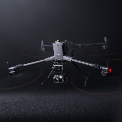
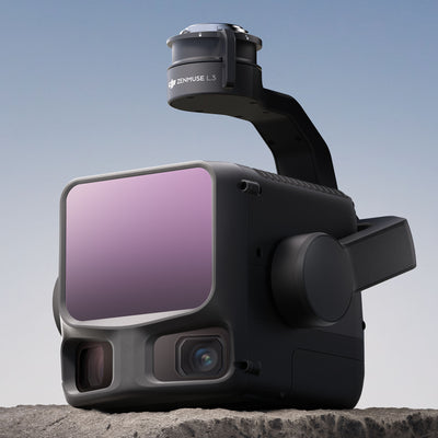
We commission aerial kits on Matrice 400 with L3 where the brief is LiDAR, and we set Terra up to the datum on the drawing. Modify we will talk through if the delivery is a mesh for someone who is not going to open LAS. We do not sell Modify off a product page.
If two visits already disagree, send both quality reports and the output CS screens. We will tell you whether it is a transform, a geoid or a POS that never got rewritten.
FAQ
Can Modify replace Terra?
No. Modify does not build a map from the flight.
Does seven-parameter mean I can skip occupying marks?
Only if you already have known pairs on the grid you need. Terra is converting coordinates you trust, not inventing them.
Can Terra process a handheld walk?
No. Export a georeferenced cloud from the handheld software and join it later. Terra is the aircraft's processor.