The folder looked like a mapping block. Overlap ticked. Terra ran. The client asked for volumes. What came off the aircraft was the thermal body: an electronic wide, JPEG only, and a 640 by 512 heat camera. July's Terra update makes that mix-up easier, because the same office software now builds a temperature map and an ortho. The temperature map is a real inspection file. It is still not the mapping file.
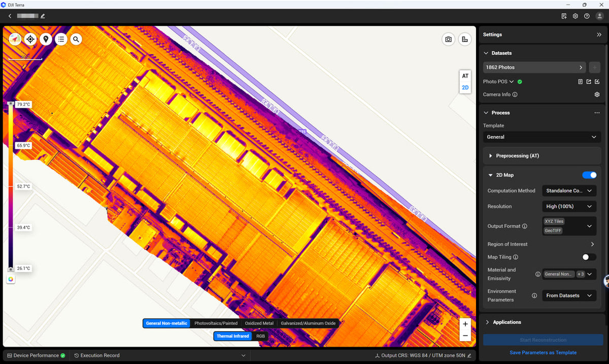
DJI Terra 5.3.0 shipped on 23 July 2026. The Enterprise Insights note followed on 31 July. The headline is Thermal Infrared Reconstruction: visible frames run aerotriangulation, thermal frames are matched onto that geometry, and the output is a 2D temperature map plus a visible ortho. Point, line and area measurements. Ten palettes. PDF or XLSX out. Rolling shutter optimisation landed in the same build, which is the other trap. Software that can tidy an electronic shutter is still not a mechanical shutter.
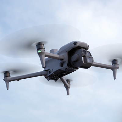
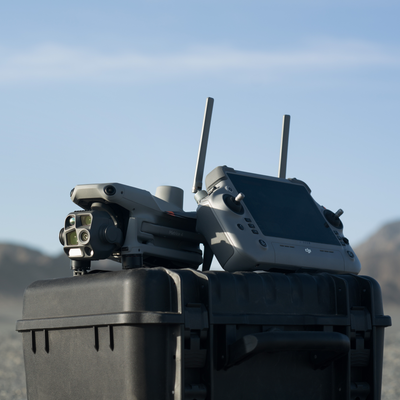
The compact pair this post is about is 4E and 4T. Same airframe class. Different wide camera. The pad-launched twins are a different compare.
What Terra 5.3 actually added
Thermal Infrared is its own reconstruction type. You pick it next to Visible Light, Multispectral and LiDAR. Pick Visible Light on a thermal card and you will wait out a job the software cannot finish. Pick Thermal Infrared on a 4E card and there is no heat channel to drape.

DJI's field note for that type is specific. Pilot 2 in orthophoto capture, both the visible and thermal lenses. Ground sample distance calculated from the thermal camera, not from the 48 megapixel wide. Overlap at least 60 percent forward and 50 percent side; 80 / 70 on water or repeating texture. Stay under 120 metres AGL, and keep the aircraft within 60 metres of the thing you care about. POS and local PPK still import. Cluster computing still runs the triangulation.
Two limits sit next to those numbers. Aerotriangulation uses the visible photos, so DJI does not recommend thermal reconstruction in low light. A night flight can still be a CASA job. It is a poor Terra thermal project. The camera also has High Gain (about minus 20 to 150 C) and Low Gain (0 to 550 C). Terra's thermal manual is blunt that Clear-mode frames do not feed this reconstruction. If the card came home in the wrong photo mode, 5.3 will not invent the radiometric file.
Supported aircraft on the Insights list: Mavic 3T, the 3TD, 4T, 4TD, H20N, H20T, H30T. 4E is absent because it has no thermal camera. That is the whole split.

Two wides, not two versions of the same drone
4E's mapping wide is a 4/3-inch 20 megapixel CMOS, 84 degree field of view, 24 millimetre equivalent, aperture f/2.8 to f/11. Mechanical shutter 2 to 1/2000 s, electronic 2 to 1/8000 s. DNG as well as JPEG. Minimum interval 0.5 s. Distortion Correction 2.0 on the factory cal that Terra already knows. That is why the mapping block belongs here.
4T's wide is a different sensor: 1/1.3-inch 48 megapixel CMOS, 82 degree field of view, f/1.7, JPEG only. No DNG. No mechanical shutter on that wide. Megapixels are not the mapping advantage. The larger 4/3 sensor and the mechanical shutter are.
The thermal module is why 4T exists. Uncooled vanadium oxide, native 640 by 512, 12 micrometre pitch, 30 Hz, 45 degree DFOV, f/1.0, NETD at or under 50 millikelvin at f/1.0, 8 to 14 micrometre. Vendor super-resolution to 1280 by 1024 is not a bigger detector. Spot and area temperatures on the aircraft. High Gain accuracy DJI publishes as plus or minus 2 C or 2 percent, whichever is greater; Low Gain plus or minus 5 C or 3 percent. A NIR spotlight with a 5.7 degree beam sits beside it for night work.
Both bodies share the laser rangefinder (1800 metres at 20 percent reflectivity, 1 Hz) and the same RTK positioning spec: 1 centimetre + 1 ppm horizontal, 1.5 centimetres + 1 ppm vertical, RTK Fix. That number is the antenna, not the ortho, and not the thermal pixel.

Rolling shutter correction is not a mechanical shutter
DJI is explicit that rolling-shutter bodies smear on fast passes and long lines. Terra 5.3 adds Optimize RS Files in preprocessing, on by default when the software sees eligible frames. You can mix rolling-shutter and global-shutter frames in one dataset. Historical RS blocks can be reprocessed.
DJI's own 4T tests, area paths, 60 metres and 120 metres AGL, stable RTK: with RS optimisation on, about 3 to 4 times GSD horizontal and 4 to 5 times GSD vertical. Those are their conditions. They still point the high-precision mapping job at the mechanical-shutter body. Read that sentence twice before you sell a 4T mapping block on the back of 5.3.

A 3 to 4 times GSD horizontal number on a 4T wide is also not a thermal GSD. For a thermal project DJI wants GSD from the 640 by 512 array. The temperature map is coarse compared with a 20 megapixel 4/3 frame even when the colour overlay looks sharp, because the sharpness you are admiring is often the visible channel.
What a thermal map is allowed to claim
The number on the map is a temperature after correction, not a palette. Terra lets you set material emissivity (built-in library, or a custom value; DJI's example for general non-metal is 0.95). Environment parameters default to From Datasets: atmosphere temperature, reflected temperature and relative humidity read from the R-JPEG. Custom is for files that never stored those tags, or for a uniform correction you are prepared to defend.

Output is a 2D thermal DOM plus a visible map. It is not a 3D thermal mesh. Reports can carry the measurements. A single R-JPEG in DJI Thermal Analysis Tool 3 is still the frame inspector. Terra 5.3 is the stitched temperature field. Neither of those paginates an A4 the asset owner will sign. That last step is the report tool we built after TAT 3.
Night in Australia is a CASA path, not a Terra toggle
CASA's night page is short. To fly an RPA at night you need a ReOC and a RePL (or a licensed remote pilot). You also train and test the remote pilot, keep those records, run a risk assessment, and write the procedures. Instrument 01/17 is the usual insert in the operations manual, or you apply with procedures you wrote yourself. A ReOC on the wall is not night authorisation by itself.
4T's thermal camera and NIR light are why crews apply. Terra's thermal reconstruction still wants visible frames for AT, so a night card is a detection flight you inspect in TAT 3 or the report tool, not a 2D thermal map you promised the client at 9 pm. Standard operating conditions for excluded operations also ban night. Do not quote a compact thermal aircraft as if the software update moved the law.
If the file has to sit on an Australian drawing, name GDA2020 and the height system in Terra the same way you would on a 4E block. The Insights screenshot is WGS 84 UTM. That is DJI's demo, not MGA2020 Zone 55 with AHD. Repeated surveys still die on that choice.
What the reviewer should open
Thermal Infrared project type, not Visible Light. Both lenses in the photo gallery, not thermal-only. Quality report for the visible AT: coverage, overlap, POS source. Material name and emissivity written down, not left on whatever Terra defaulted. Environment parameters From Datasets unless you can explain the custom atmosphere, reflected temperature and humidity you typed. Output CRS the same as the drawing, including the geoid. Independent check shots on hard, open ground if anyone will treat the visible ortho as geometry. If the brief was temperature, the report should say High Gain or Low Gain, and whether the number is a point, a line or an area.
A 4E mapping review is the other list. Mechanical shutter on. Dewarping off. DNG or JPEG as you planned. Same CRS as last month. Check shots. The quality report. Do not paste the thermal checklist onto that block.
Failure modes
Flying a mapping block on 4T and invoicing it as the survey because Terra 5.3 can now "do thermal maps" and "fix rolling shutter." Those are two different project types.
Building Thermal Infrared Reconstruction from Clear-mode frames, or from thermal-only capture with the visible lens off. AT has nothing to tie.
Running a Terra thermal project at last light. DJI already told you not to.
Flying 4E at dusk for a hotspot. There is no radiometric channel. RGB of a warm thing is not a temperature.
Mixing 4E and 4T frames in one reconstruction because 5.3 allows RS and global-shutter in the same set. That is how a mapping block inherits the electronic wide.
Treating 1280 by 1024 super-resolution as native thermal pixels.
Leaving emissivity on the default while the surface is glass, bare metal or a wet roof.
Reading this URL when the aircraft lives on a pad. That buy is 4D versus 4TD.
What we have not tested
We have not published an Australian side-by-side RMSE of a 4E photogrammetry block against a 4T block with Terra 5.3 RS optimisation on, on the same site, against independent check shots. DJI's 3 to 4 times GSD / 4 to 5 times GSD figures are their 60 metre and 120 metre area tests with a stable RTK fix. We have not repeated that pair here. Interiors are a handheld walk, not a compact airframe argument.
Where we stand
The mapping aircraft we quote is 4E. The thermal aircraft is 4T. We set Pilot 2, AUSCORS and the Terra project type on commissioning. We do not fly the site for you.
If you already have one card from each body, send both folders. We will tell you which Terra project type you actually have, and whether the thermal set was captured in a mode 5.3 can use.
FAQ
Does Terra 5.3 turn 4T into a mapping camera?
No. Thermal Infrared Reconstruction drapes heat onto visible AT. Rolling shutter optimisation tidies the electronic wide. DJI still points high-precision mapping at the mechanical-shutter body.
Can I build a 2D thermal map at night?
Not as a Terra 5.3 thermal project. AT needs visible photos, so DJI does not recommend low light. Night flight is a CASA ReOC path. Inspect those frames as R-JPEGs.
Is 1280 by 1024 the real thermal sensor?
No. Native is 640 by 512. Super-resolution is a processing mode.
Can I mix 4E and 4T photos in one reconstruction?
Terra 5.3 will let you mix rolling-shutter and global-shutter frames. That is how you contaminate a mapping block. Keep the bodies in separate projects.
Do I still need check shots if RTK is fixed?
Yes. RTK is the antenna. Check shots catch a wrong CRS, a geoid you never applied, and a thermal map you are about to treat as geometry.